Tuesday 31 May 2016

Day 40 - Zero in Lake Isabella

Lake Isabella is well off the trail being a 37 mile hitch on the road to Bakersfield but it is the best option for a resupply.
Hitching was a problem with minimal traffic however a guy with his daughter eventually picked me up for the full trip.
Lake Isabella is a bit like Tehachapi in that it is spread out. An excellent breakfast at Neldas Diner was followed by a laundry & eventually a shower at the motel Buff & I decided to share. Food for the next stretch was also sorted. The real killer has been the heat. Lake Isabella sits in this oven of a valley & heaven knows how hot it was today. We will need to get on trail early tomorrow to beat the stifling afternoon temperatures. A couple of shots of Lake Isabella

An interesting aside to the day was a discussion with Mayor - the guy with the dog on trail. He also has ' done the Appalachian Trail but wrote a book that he self published on Kindle. The book "Lost on the Appalachian Trail" has moved a significant amount of copies which nets him 70% of royalties that are paying for his PCT trip. An interesting guy & got me thinking....Weta

Day 39 - Memorial Day

Mile 633.29 to Walker Pass - 18.71 miles. Distance from Mexico 652 miles

Today was Memorial Day in USA which is the equivalent of our Anzac Day. I tried to quiz some people on trail about it but it seems more like a day for folk to get together for a BBQ over the long weekend. In the case of our hike today it was also a chance for dirt bike riders & off road vehicles to stretch their pistons.
Overall though it was a quiet day after the euphoria of day 38. The initial climb to the top of the ridge I camped on gave us a view in the distance of what was to come - snow on the Sierras
We gradually worked our way down the ridge to end up in an old fire damaged area - the 3 mile walk on the unpaved road through this not being the most enjoyable part of the day. The afternoon elevation drop in the energy sapping heat was made more palatable with Buff & Zombie Dust (it's a beer brand) for company from lunch onwards.
Our campsite at Walker Pass was not the most attractive that we have encountered with little cover from the heat & wind. We also had plenty of bugs to contend with. I did however catch up with Topo & also chanced upon an amaetuer astronomer with some very expensive equipment. Zero Day tomorrow in Lake Isabella....Weta

Day 38 - Wow....wow....oh wow. What a day!!!!

Landers Meadows to Mile 633.29

Best. Day. So. Far. I've been a bit "let down" by not experiencing the true desert-like conditions I was expecting. I got that today - & was just blown away by the stark, brutal but stunning landscape unfolding before my eyes. Around every corner was another jaw dropping moment. I was the proverbial kid in a candy store. Late in the day I was talking with the Dutch fellow Frank and we agreed that the day had been outstanding with both of us having taken more photos than at any other time.
I got that early start at 5.15 am to try and beat the heat (in the two days following it was expected to get to the late 30s/early 40s). After spooking some deer first thing I dodged in between these Mayan type mountain tops which looked magical in the morning sun & nestled amongst the purple lupin bushes

After dropping off the ridge we had been in for 3 days we got a welcome surprise with a water cache with the typical vortex of bodies
From left to right - 63 year old Buff from Northern California. Lovely bloke but nursing some ugly heel blisters. Banjo. Neck tie who wears a......neck tie - an English chap who carries a guitar, sings like an angel & knows Nick Cave :-). Speed machines The Graduate & T-Rex who put in 30 mile plus says. Somewhere around were The Prodigy and Butters who keeps losing stuff (as in butter fingers).
For the next few miles I climbed up to a pass (finally heading north after tracking east) that was simply stunning.
The view north to the barren Joshua Tree landscape was compelling
To the west was this boulder strewn monolith
To the south you can see the road crossed before heading up the pass
To the east these tor like mountains appeared all day - like what you'd see in the UK on Dartmoor
The trail then edged around a mountain to look out over a deathly looking valley before passing the 1000 km mark. After shading to avoid the midday baking sun & the biting flies I then hiked in the heat in the jaws of the nearby Mojave. One tough climb was made worse by having soft sand underfoot - a bit like walking uphill in the soft shifting sand at Ocean Beach. The sweat was cascading off me but I was on a natural high by now & the effort was exhiliratingly exhausting. The reward was a view over the Mojave that no photo could replicate but Frank's gaze said it all
After a bonus 2nd water cache it was a gruelling scramble up the 7000 foot Skinrier Peak to end the day. I bailed at 6430 feet when I found a magical spot to set up after an amazing day with this view
Wow. Weta

Day 37 - Ridge Walking

Mile 592.9 to Landers Meadows - 16 miles. Distance from Mexico 608.9 miles

Solid day today following the ups and downs of a ridge at around 6500 feet. Most of the day was in amongst pine trees including our campsite at days end at Landers Meadows. There was an early climb which rewarded us with this view (Johnny in shot)
We had a great lunch spot at Robin Bird Spring not long after passing the 600 mile mark (although the locals firing away at the wildlife nearby made us a bit edgy with some black humour filling the void)
The ground later in the day was covered with these beautiful purple flowers
Water has been a big issue on this stretch with this spring at days end typical of what we rely on & in this case the last natural water source for 42 miles
The next two days could be the most testing so far as we hit dry open terrain with the prospect of rattlesnakes and only Joshua Trees for shade. We are "confident" of water caches en route but will look at trying to counter the heat by getting an early start.....Weta

Day 36 - Heading North

Mile 572.9 to Mile 592.9 - 20 miles

At last we feel like we are heading towards Canada. Over a number of days I have stared at my shadow in front of me in the mornings as we've tracked west. Now I have my shadow on my left in the mornings and my right in the afternoons - must be heading the right way then
The camera pointed north!!!
It was a steady day with a couple of gnarly ups and some welcome downs but I was pleased to see camp at the end of a day of ridge hopping.
One of more unusual thru hiker companions was chilling at lunch
That's Mayor in the left and Katana (Trail Name - Catfish) on the right. A Japanese Hunting Dog, she would be the most docile, friendly and good natured dog I've ever encountered and she's already a veteran of the Appalachian Trail.
It was another gorgeous wildflower day with some different blooms on the trail

The white flowers were a blaze of colour inside which the bugs were devouring.
Only 107 miles to Kennedy Meadows....Weta

Thursday 26 May 2016

Day 35 - On The Road Again

Tehachapi Pass to Mile 572.9 - 14.6 miles

Back in the saddle today. Picked up a ride from a friendly local to my start point with the first 8 miles wandering the ever growing pile of windmills. The first target was a road/rail crossing
Thank goodness we had an overpass as my road crossing skills in USA would have had me run over getting across this lot - look left first!!!!
We then got down to business with a 2000 foot climb up to a 6000 foot ridge where I found this cool campsite which was mostly sheltered from the incessant wind
That's Banjo in shot who finally caught me up today after waiting for delivery of shoes in Wrightwood.
The climb had us gazing out over the Mojave Desert with the road/rail slicing across the nothingness & the occasional cluster of buildings being desperate towns & facilities like Lockheed or is that Edwards Air Force base in the distance?
Being up on top of this ridge I can look down on the wind farm stretching out in to the desert - it just keeps growing!!
We are in the middle of a 26 mile no water stretch to be followed by a 42 mile dry run...phew. Until next time....Weta

Wednesday 25 May 2016

Days 33 & 34 - A Double Zero in Tehachapi

A Double Zero??
No....I am not injured or ill or fatigued (well a bit tired). The conundrum we are all facing is the Sierra Mountains which have had late season snowfalls. Its been cold here - believe me. With the gateway of Kennedy Meadows only 140 miles away, the problem we have is arriving too early there & finding out that we have to throw out the anchor to wait for the snow to recede. So it's better to stop up here at $5 a night & where there are better options for food &/or catch a movie etc.
I will also cut back on the miles per day over the next 140 miles to 1) delay my arrival at Kennedy Meadows & 2) to be super careful over the next stretch which has waterless sections up to 40 miles apart - carrying 6 litres of water & a full complement of food is challenging!!
The delays mean our group will separate with some even choosing to jump ahead to do the Oregon section then returning to do the Sierras late July. I considered that but like the idea of one long continuous trek.
So here I am in Tehachapi - on the face of it a prosperous town with a lot of new development. It's seems to be built on mining with large open cast quarries nearby that I understand have been mined for gold, silver & aggregate for concrete. It's other notable feature is the railway line running through the centre. The trains are monsters as they carry freight to & from the port at LA. Like the one in the photo they often have up to 5 locomotives up front, take many minutes to roll past & sometimes have two locomotives at the rear to assist
There other nuance is the sequence of very loud warning blasts on their horns when they approach a crossing (you count them in the night)...2 long blasts as they approach, 1 short blast as they are about to cross them another long blast as they exit. And there are no protocols about decibel issues at 2.30 am.
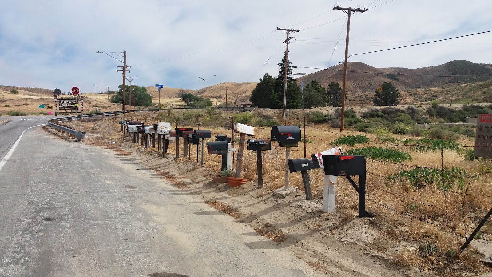
The town is spread out with an older centre well preserved
and a modern retail area about a mile away from the centre with all the usual big box culprits. Lovely people as well & always interested in what you are doing.
I try to stay positive about the PCT but there are three things that irk more than others:-
1. Sand - Southern California is full of it. You walk in it, camp in it, breath it. It gets in your tent, your sleeping bag, your pack, your clothes, your food, your eyes, your shoes......aarrrggghhh. Its been bliss camping on grass the last few days.
2. Finding a flat camp site - get it wrong & you spend the night sliding around your tent not sleeping. Oh & did I mention dealing with the sand??
3. Miles - do you know how hard it is to get used to the concept of miles instead of kilometres?? You look at your map while hiking & see that you have 5 miles to travel. No problem when you think automatically in kilometres - only to realise it's miles & you are looking at 2 more hours of slog. I guess by the end of this I will be accustomed - like trying not to get run over crossing the road (damn cars come from different directions don't they).
Enough rambling. Internet coverage starts to get very patchy so will update the blog when I can...Weta

Monday 23 May 2016

Day 32 - Don Quixote's Worst Nightmare

Tylerhorse Canyon to Tehachapi 16.9 miles. Miles from Mexico 558.5

This trek is not solely about natural wonders. The manmade ones can inspire as well. Coming down in to Tehachapi Pass late morning I was increasingly incredulous at what was unfolding in my field of vision. We are all familiar with the wind farms around Palmerston North. Well this is on another level. We are not talking hundreds - we are talking in the thousand plus range. A photo cannot do it justice as all up this valley it was just windmill after windmill....all sizes & spewing out on to the desert floor. Astonishing.
And out in to the desert....you need to see it to believe it
A 5.45 am start meant I could watch the sun rising over the Mojave Desert. Once again it is hard to capture by photo as a blue haze makes it look.....well hazy
In PCT style we had a tough 1800 foot climb to get the heart rate up. At the top we had this waiting
This couple had left out apples, water & chairs. Chairs are bliss & hugely underrated. Trying to do anything without a chair is....well put it this way, there are not many rocks & trees that make a good substitute. Talking to a fellow hiker later in the day he mentioned that he stayed up there & in the morning the couple called over with a pot of coffee!!! They live nearby in a mountain cottage....made for a great start to the day. The rest of the hiking was some of the easiest of the trail with a drop down to the road to Tehachapi where a Trail Angel picked me up for the 10 mile trip to town where I am now....lying on my tent listening to the umpteenth massive train heading out towards the Mojave. Zero day tomorrow here in this clean & prosperous town....Weta

Day 31 - Joshua Tree Day

Mile 521.5 to Tylerhouse Canyon - 20.1 miles. Miles from Mexico 541.6.

When we camped on Day 30 there was "discussion" around whether it was a Joshua Tree forest or not?? After consulting Mr Google & checking other specimens en route we agreed that we were amongst young Joshua trees. They have unusual fruit while also providing us with the only shade all day
For the most part of the day we followed the LA aqueduct & then later on picked out way through a wind farm - all on the fringes of the Mojave Desert
The trail was designed this way to avoid using private land that bordered the area.
It was a generally flat to celebrate one month on the trail but late in the day the PCT did what it is best at with an 1800 foot grind to reach out campsite...Weta

Saturday 21 May 2016

Day 30 - I Would Walk 500 Miles...

Sawmill Campground to Mile 521.5  - 23.3 miles

Another milestone today with passing the 500 mark, which was duly noted with a melodious version of the Reid brothers trail song
The day was one of contrasts as we started in amongst trees and ended in dry desert conditions. After an initial 1000 foot climb it was a drop to the desert floor. Views out over the corner of the Mojave we would be crossing were awesome. One shot picked up some cropping circles where irrigators were drawing water from the nearby LA aqueduct to draw life from the desert - looks a bit like the patterns you see from the sky around Omarama down south
Upon reaching the bottom we decided to make the most of the mileage made to peel off another 4 miles in the desert conditions while the temperatures were cool. An route we passed by the LA aqueduct & also walked on top of an underground feeder pipe in to the system

 The day finished with us finding a cool camp site with these amazing cacti as a backdrop
So an easier day with mainly downhill & flat (a rare thing for the PCT). Tomorrow looks flatish with a climb at days end...Weta


Friday 20 May 2016

Day 29 - A Road Walk

Green Valley to Sawmill Campground - 20 miles. Miles from Mexico 498.2.

Actually it was only 17 miles as we had to go off trail for 13 miles to get around a fire damaged section of the PCT. So about 11 of those miles was road walking which was okay as you get to see bits of small town USA life. I reckon I could be a postie here as this makes the job easy
Before we left this morning though I took a photo of the 2016 PCT class signed sheet at the Anderson's - don't know who the random guy is in the photo
When we finally got back on trail it was pleasant going on top of a ridge in amongst trees which is weird given our proximity to the desert
When we did get to camp it wasn't long before we hit out sleeping bags as it is very very cold. Hardly got to 12 degrees today & the cold wind at 5000 feet had it very much in single digit figures. And we hit the desert tomorrow!!
Forgot to mention yesterday we were occasionally buzzed by military aircraft as Lockheed have a testing facility nearby while Edwards Air Force base is also close by - that's where the space shuttles used to land....Weta

Day 28 - Point A to Point B

Agua Dulce to Green Valley - 23.7 miles. Miles from Mexico 478.2.

Today was one of THOSE days. PCT was doing what it does best with the Trail going up & down four ridges. Most of the Trail was in low scrub so scenery wide it was hard to stay enthused - especially after the 3 hour grunt up the first 1500 foot climb.
LA needs water which is a problem when it never rains. So these reservoirs feed its thirst
LA also draws water everywhere including from the Sierras where itis channelled south through aqueducts.
I saw two more rattlesnakes today with one accompanied by a swarm of bees.
Our day ended at Trail Angel Terri Anderson's home in Green Valley. Handed a loud Hawaiian shirt when we arrive the camping set up comes next. It is in this enchanted forest type setting
For a donation we get fed a taco salad then pancakes and coffee in the morning. She is one hard case left who has been doing this for 17 years - including the big hug gives you when you arrive. A neat place to stay Weta

Wednesday 18 May 2016

Day 27 - Zero in Agua Dulce

And I needed it to give some tender soles a rest along with everything else. Hiker Heaven arranged lifts in to LA for some gear purchases & resupply. With a population of 12 million in all it's linked cities LA is BIG.
Hiker Heaven is run with military precision by a couple who lay so much on for us including using their back yard
Internet, laundry, showers etc are all gratis - amazing.
Agua Dulce has a lot of horses with little private equestrian facilities. How do I know this? Well Brian & Amy who hosted us at Wrightwood have a little aerobatic plane based here & offered to take us up for a spin :-). So Goldfish, Joe, Bad Mash & I each went up for a 30 minute spin - just awesome
Here's Goldfish in red greeting Bad Mash after his flight. Goldfish is a pilot back home in Canada & he was just itching to get in.
Back to reality tomorrow when we have a week of hot dry conditions ahead of us. Until then...Weta

Day 26 - Snakes!!

Messenger Flats to Agua Dulce - 24.1 miles. Distance from Mexico - 454.5 miles

Well you don't see this every day in NZ
This young rattlesnake was parked on the middle of the track giving it full noise. The young ones are dangerous as they don't know how to control the venom they emit. I'm now in an area where the Mojave rattlesnake lives. A vote from this green baby means I'm coming home in a container you can't open from the inside.
I also chased a tarantula hawk around the desert today as it was diving in to holes looking for prey. These giant fly like creatures with a blue undercarriage & orange wings are like helicopter gunships - no photo though :-(.
We have dropped down to Agua Dulce which means we are entering desert terrain. There was a great photo to have early on though
In the afternoon we entered the Vasquez Rocks area named after some bandit. Wow. Jaw dropping canyons and a vista of strata layered outcrops used in Star Wars and Star Trek


There were also signs explaining local genus which was interesting (no broad beans though Ruth).

Ended up a Trail Angel place called Hiker Heaven which is a backyard full of people. More about that tomorrow... Weta