The ascent of Mount Whitney (the highest point in the bottom 48 states with Denali in Alaska higher) is not part of the PCT but because of its proximity to the trail it is not turned down by many - our PCT thru hiker permit giving us permission to climb from the John Muir Trail side. Others come from the portal on the Line Pine side which is permit controlled. At 14505 feet (Mount Cook is 12218 feet) I don't think I will ever get the chance to climb this high again (unless I trek in Nepal) so this was my Everest and what a day it was...
From our campsite it's a 3853 foot climb over 7.5 miles with the big question mark being the elevation. Banjo, Schweppes, Scabs & I set off at 5.40 am with the first highlight being Timberline Lake from which we had a clear view of Whitney
The trail goes to the right up a glacial valley. We then climb a switchback to the right of the long sharp ridge. We then scramble along the ridge from right to left and up to the summit which is on the left but on the eastern side hidden from view.
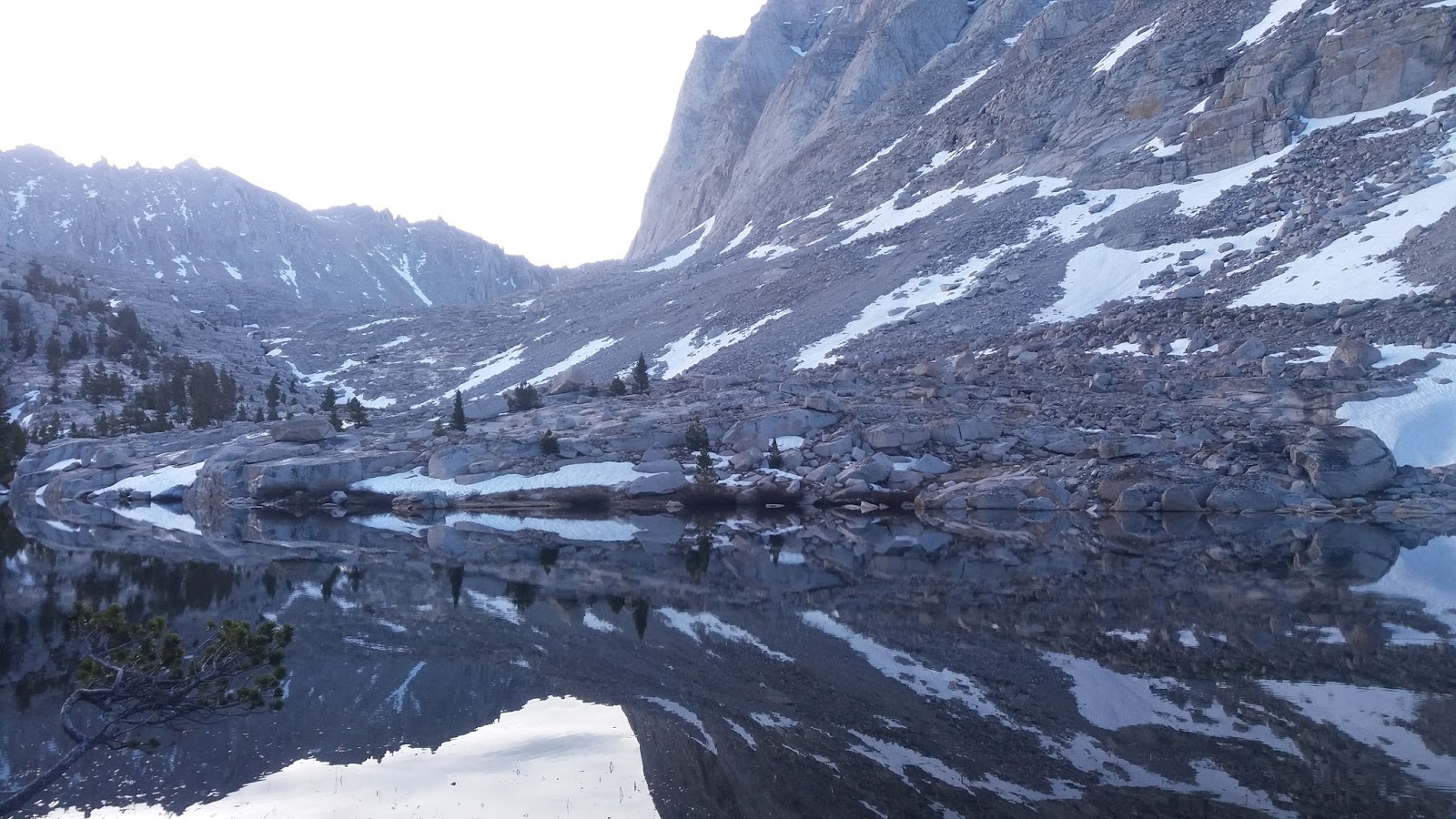
Timberline Lake had gorgeous reflections on the water
Further up we had this massive tower of rock look over us which I renamed Cathedral Towers
We then skirted around Guitar Lake
before crossing ice packed snow to start the switchback climb. The ice and snow made it tricky in places but it was just a good hard slog
The trail joins the Whitney Portal from the eastern side with a warning about lightning
Surprisingly the elevation did not affect me and I picked up the pace along the top before 400 metres of a snow covered slope and one last sprint up the table top to the summit had me stop tbe clock at 4 3/4 hours. I was a happy camper...
The other folk are those that have ascended up the Whitney Portal as day hikers.
It's hard to translate the view in to photos with the Sierras to the North West, Owens Valley to the East and my PCT trodden path to the South.
Whitney has a sheer drop off on the eastern side which climbers use (Scabs getting a fright when two appeared over the rim later on). From the summit you can see this amazing glacial lake
There is a stone shelter near the summit
North West and we can see the mountains we will travel through in the next 200 or so miles to Yosemite
There was a bitterly cold wind at the summit so we had to find shelter in the rocks that were populated by chipmunks (which eat what??). We also saw dear on the way up as well as Jack rabbits and the ever present marmots.
The descent took about an hour less with a nice view of the Hitchcock Lakes all frozen over
A wonderfully satisfying day in which I felt good all day. The day ended with a long chat with England (from England - funny that) and his time in NZ. Like many others I have met, he would love to live in our cool little country...Weta


This is spectacular Roger. Only now cottoned on to slide showing your photos. Have to imagine what its like to breathe that thin air. David
ReplyDeleteWeirdly enough it wasn't that bad although some coped better than others. Its about exhaling properly. I imagine those trekking in Nepal or visiting Bolivia would have a tougher time of it!!!
Delete